<template>
    <view class="all-view uni-bg-gray">
        <map id="navmap" :style="'width: 100%;height:' + allViewHeight +'px;'" :latitude="src_latitude" :longitude="src_longitude" :markers="markers"
         :polyline="poly" :hidden="false">
        </map>
    </view>
</template>

<script>
    import {
        mapState,
        mapMutations
    } from 'vuex';
    import amap from '../../amap-wx.js';
    export default {
        data() {
            return {
                src_latitude:0,
                src_longitude:0,
                des_latitude:0,
                des_longitude:0,
                //地图停车场标志
                markers: [{
                    id: 0,
                    iconPath: '../../static/img/icon_address_blue.png',
                    width: 22,
                    height: 32
                },{
                    id: 0,
                    iconPath: '../../static/img/carpark.png',
                    width: 22,
                    height: 32
                }],
                poly:[],
                allViewHeight: 800,
                searchObj:null,
                nav_map:null,
                info:'',
                parkname:'',
                bodytext:''
            };
        },
        computed: {
            ...mapState(['amapKey'])
        },
        onReady(options) {
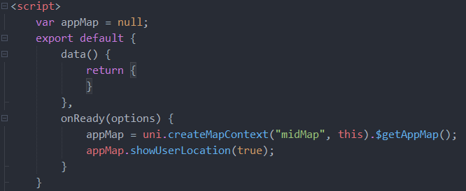
            var nmap = uni.createMapContext("navmap",this).$getAppMap();
            this.nav_map = nmap;
            let self = this;
            nmap.showUserLocation( true );
            console.log("map:::::"+JSON.stringify(nmap));
            var searchObj = new plus.maps.Search(nmap);
            searchObj.onPoiSearchComplete = function( state, result ){
                console.log("onPoiSearchComplete: "+state+" , "+result.currentNumber);
                if ( state == 0 ) {
                    if ( result.currentNumber <= 0 ) {
                        alert( "没有检索到结果" );
                    }
                    for(var i=0; i<result.currentNumber; i++){
                        var pos = result.getPosition( i );
                        var marker = new plus.maps.Marker( pos.point );
                        marker.setLabel( pos.name );
                        map.addOverlay( marker );
                    }
                } else {
                    alert( "检索失败" );
                }
            }
            var pt = new plus.maps.Point( self.src_latitude, self.src_longitude );
            searchObj.poiSearchNearBy( "停车场", pt, 1000 );
        },
        onLoad(options) {
            setTimeout(function() {
                let allView = self.getSystemInfo();
                allView.then(function(res) {
                    console.log(res.windowHeight);
                    self.allViewHeight = res.windowHeight;
                });
            }, 500);
            //console.log(JSON.stringify(options));
            //console.log(JSON.stringify(this.markers));
            this.src_longitude = options.origin.split(",")[0];
            this.src_latitude = options.origin.split(",")[1];
            this.markers[0].latitude = this.src_latitude;
            this.markers[0].longitude = this.src_longitude;
            this.info = options.info;
            this.bodytext = options.bodytext;
            this.parkname = options.parkname;
            this.des_longitude = options.destination.split(",")[0];
            this.des_latitude = options.destination.split(",")[1];
            this.markers[1].latitude = this.des_latitude;
            this.markers[1].longitude = this.des_longitude;
            let self = this;

            this.amapPlugin = new amap.AMapWX({
                key: this.amapKey
            });

            this.amapPlugin.getDrivingRoute({
              origin: options.origin,
              destination: options.destination,
              success: function(data){
                var points = [];
                if(data.paths && data.paths[0] && data.paths[0].steps){
                  var steps = data.paths[0].steps;
                  for(var i = 0; i < steps.length; i++){
                    var poLen = steps[i].polyline.split(';');
                    for(var j = 0;j < poLen.length; j++){
                      points.push({
                        longitude: parseFloat(poLen[j].split(',')[0]),
                        latitude: parseFloat(poLen[j].split(',')[1])
                      })
                    }
                  }
                }
                 self.poly.push({
                     points:points,
                     color: "#0091ff",
                     width: 6
                 })
                 console.log("路线信息:"+JSON.stringify(data.paths[0]))
                if(data.paths[0] && data.paths[0].distance){
                  console.log("共计长度:"+data.paths[0].distance);
                }
                if(data.taxi_cost){
                    console.log( '打车约' + parseInt(data.taxi_cost) + '元')
                }

              },
              fail: function(info){

              }
            })
        },
        methods: {
            getSystemInfo() {
                return new Promise((res, rej) => {
                    uni.getSystemInfo({
                        success(data) {
                            res(data);
                        }
                    })
                })
            }
        }
    }
</script>

<style>

</style>
刚接触uniapp,烦请各位指导一下 谢谢!!!
上面得vue文件内容
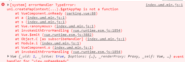
问题如下:


7***@qq.com
大佬,我也是卡在这里了
2019-04-26 17:17
3***@qq.com (作者)
回复 7***@qq.com: 你编译模式是自定义组件模式吗 我改成直接使用原生Map组件了 ,我看HbuilderX最新版好像说有更新这一问题 也没试
2019-04-29 10:04
x***@qq.com
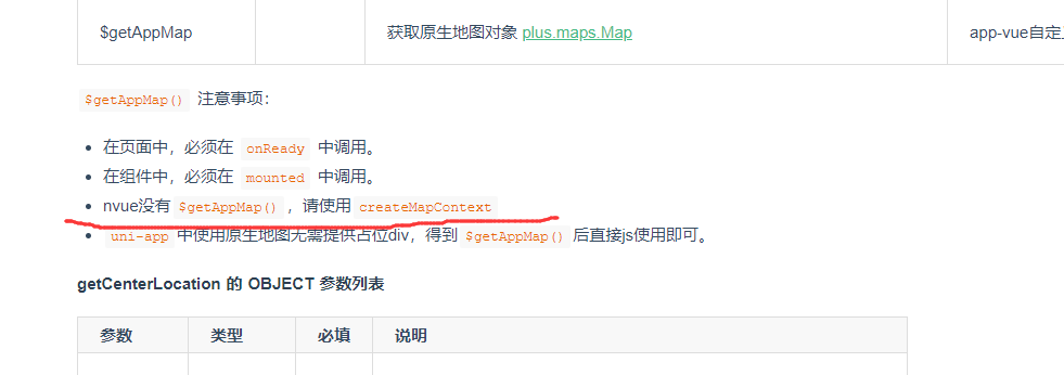
uni.createMapContext("navmap").$getAppMap 这个问题解决了么?怎么解决的?谢谢
2019-05-10 15:16
虫子的辛苦
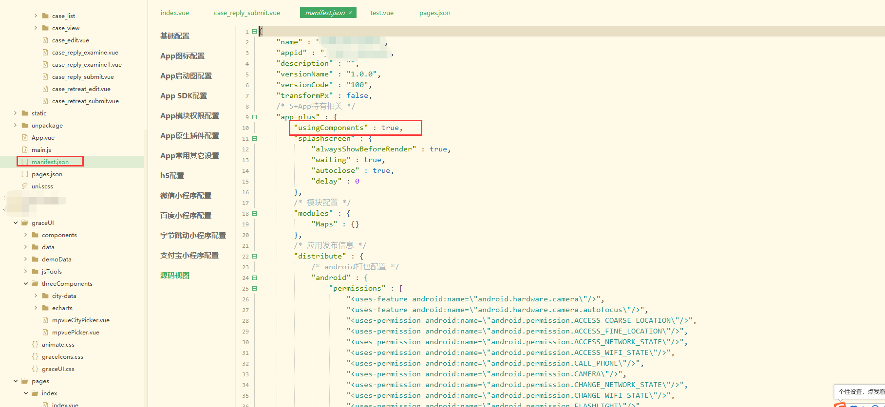
回复 x***@qq.com: 在配置文件manifest中选择源码视图,然后在这里增加参数 "usingComponents" : true就好了,我的已经解决
"app-plus" : {
"usingComponents" : true,
2019-06-15 11:55
snail_lt
回复 虫子的辛苦: 大佬,我这样写了在h5还是报错。。在app模拟器可以调用
2019-09-03 11:42